
Terra Resource Planner
The most reliable route planning solution in the Greek market
Dynamic Routing
Plan immediately your routes for the next days or hoursIDEAL FOR IMMEDIATE USE
Create dynamic routes instead of static / main routesAutomated Design
Based on parameters for vehicles, roads, orders and warehousesIMPORT FROM EXCEL FILES
All you need to do is to import vehicles and orders from excel filesWeekly Plan
Plan your routes for the next week or monthIMPLEMENT TIME SCHEDULE
Create and edit long-term route plansAutomatic Vehicle Location (AVL)
View in real time your vehicles on the mapREAL TIME VEHICLE SUPERVISION
Collection & processing of vehicle dataProof of Delivery (POD)
Receive a notification on order deliveryTWO WAY COMMUNICATION WITH THE DRIVER
Send and receive text & image messagesGraphs & Diagrams
View charts and gauges and understand the organization of your routesCOMPREHENSIBLE DIAGRAMS
Automatically created by the data of your routesHow it Works

Parameters & Available Resources
VRP, when solving the problem, takes into account a number of parameters that contribute to the configuration of the route. Initiate the system and for each route, only enter orders, from an excel file
Calculate the Solution using advanced ESRI algorithms that minimize the routing cost

View the results in interactive maps and excel like tables with grouping, sorting and filtering options

Calculate alternative scenarios by modifying the parameter values within the application GUI or by importing new excel files for order, vehicles and / or distribution centers
Application’s Features

Road Network of Terra Mapping the Globe SA
It is based on Terra’s navigable road network, of a total length of 320,404 kilometers that covers the entire country
Terra Web API
Use of Terra Resource Planner services to your applications via “Terra VRP API”
Underlying Technology
ESRI’s technology, the world’s most widespread geographic information system software as well as open source technologies
Application Functionality
Parameters & Available Resources
VRP, when solving the problem, takes into account a number of parameters that contribute to the route planning.
Indicatively, these parameters may be:
- Fleet characteristics:
- Vehicles (number, capacity, maximum allowed speed, fuel type, operating costs, starting position, arrival location)
- Drivers (number, availability, skills, cost, overtime costs, driving time)
- Orders (number, delivery times)
- Distribution centers (number, capacity, types of goods, hours of operation)
- Road network (categories, speeds, directions, U-turns)
The complexity of the problem and the resolution time depend on the number of parameters. These parameters are calibrated by each company and are taken into account when solving the problem.
When initializing the system, the solution parameters are set and the depot and vehicle data is imported from excel files. From this point on, for calculating routes, all you need is to import your order data order data from excel files.

Importing the EXCEL file of the Distribution Centers
Routing Calculation
Route calculation is done using ArcGIS Enterprise Server’s Network Analyst module of ESRI.
![]()
Network Analyst Routing Software is based on the well-known Dijkstra Algorithm for finding shorter paths between nodes in a graph.
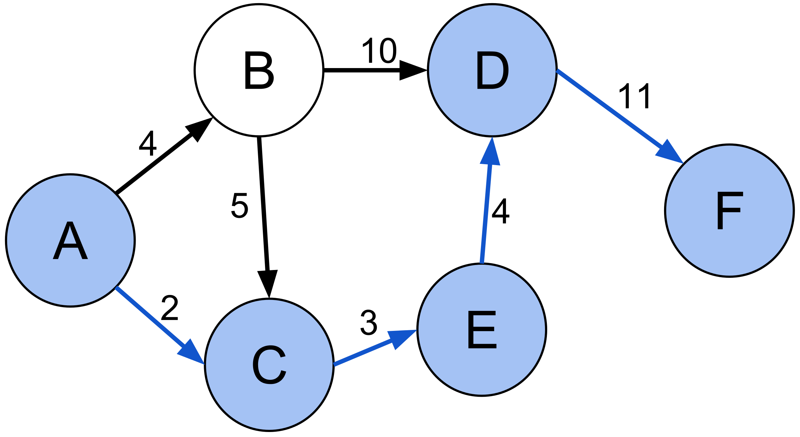
Calculate the Best Route from point A to point F
This algorithm respects user settings such as one-way constraints, U-turn constraints, barriers and road constraints while minimizing the cost of routes based on user-defined parameters.
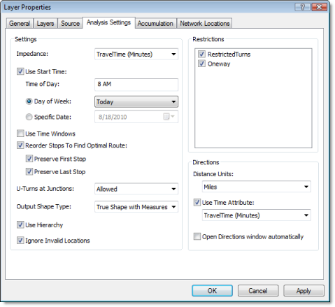
Dialog Box (in Desktop Application)
Results
View the results of the solution (vehicles and orders) in any way you want in terms of sorting, grouping and filtering, easily and quickly from excel like tables displayed on the application screen. See the statistics for each vehicle in the corresponding aggregated column.
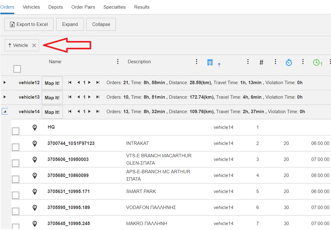
Grouping based on the vehicle
View the filtering results on the map or select a route from the map and see it in the table view.
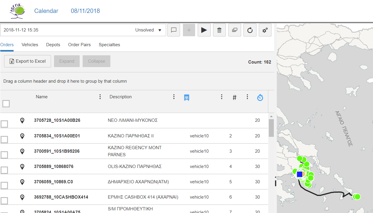
Filtering by vehicle
Export the results to excel files.
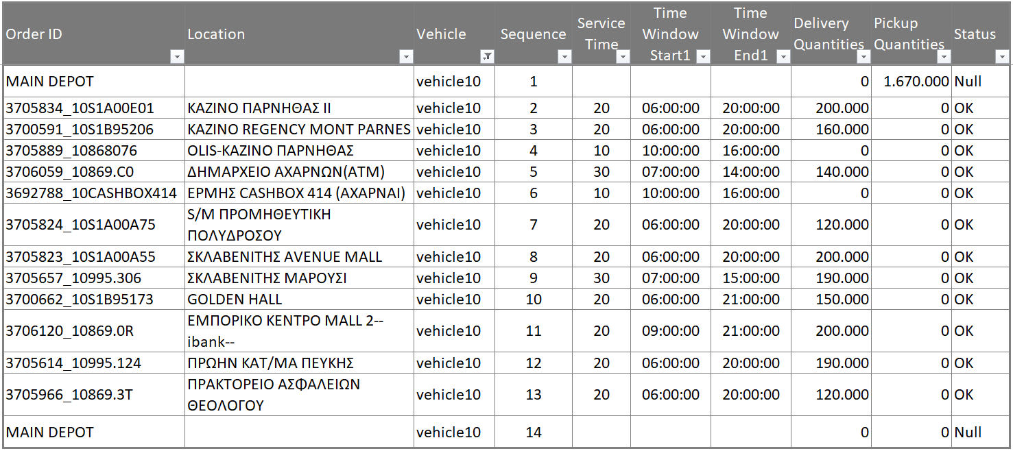
Route of Vehicle No 10
See charts.
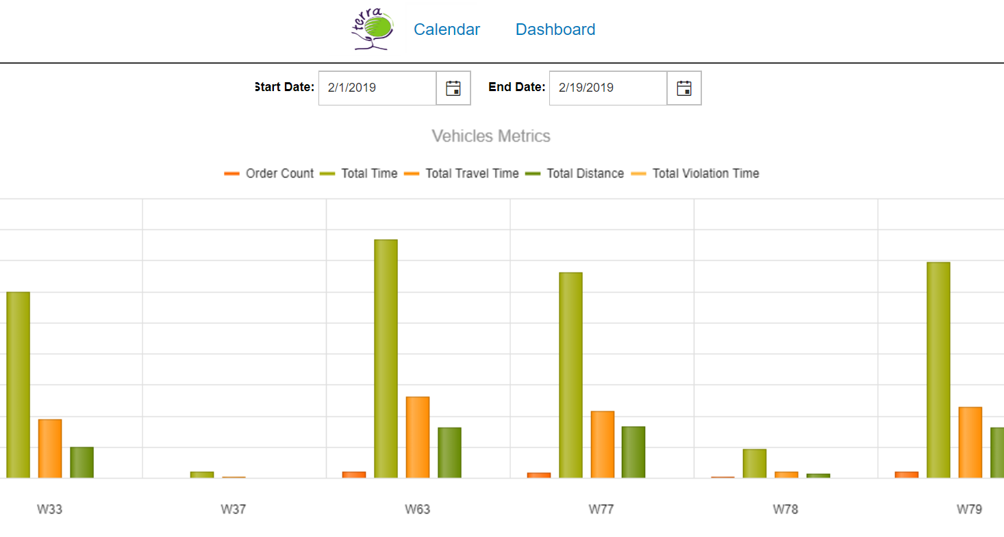
Diagrams
Alternative Scenarios
Data can lead either to a successful or unsuccessful solution to the problem.
Successful Solution means servicing all orders based on input data:
- assignment of vehicles with routes and drivers with vehicles
- route instructions (on map and in the form of descriptive instructions)
- route cost (cost, time and distance)
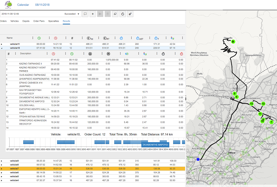
Successful solution: all orders are served
Unsuccessful Solution:
- the solution that exhausts all available resources, appears and shows the above results
- displays orders that are not served
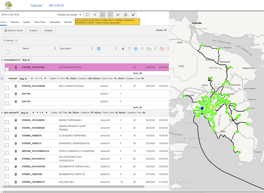
Unsuccessful solution: one order is not served
In any case, the user can implement alternative scenarios by changing the parameters and constraints. In the case of unsuccessful solution, the user, based on the results, may relax the constraints or increase the resources to serve all orders. Or he can choose the proposed solution and transfer non-served deliveries to another route.

What else ?
Terra VRP with useful and functional features, allows fast and reliable route planning. But it is not only this; supported by the largest GeoInformatics Company in Greece (with significant experience in large and complex projects implemented with a multitude of technologies), it is trusted by the largest security, retail, courier and distribution companies in their daily operations.
- Cloud & SaaS Application
- Flexible change of scenarios
- No technical knowledge is required
- Big GeoInformatics company
- Continuous and local presence
- Content – Use of Terra’s geographic road network database
- Fast delivery