
ACS Courrier
Terra, Mapping the Globe designed and implemented a pioneering system for the organization of Courier Services using Geographic Information Systems technology to upgrade ACS Courier services incorporating into it the company philosophy, experience and expertise.
The system provides solutions to the following issues:
- Cartographic data display (stores, customers, routes, etc.)
- Boundary design and maintenance of store service areas (address book creation)
- Creating optimal routes calculation based on the parameters: means of transport, timetables of the couriers’ and the orders to be delivered
- Facilitating and communicating couriers’ using mobile devices
Solutions are implemented through the following subsystems:
- Address Book creation
- Subsystem for Creation – Integration of existing Stores’ Service Areas
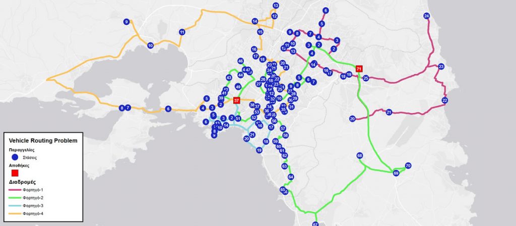
- Vehicle routing problem (VRP) calculation
- Distribution management subsystem in the store
- Mobile devices subsystem
System implementation was based on the Vehicle Routing Problem (VRP) algorithm.
Vehicle Routing (VRP) calculates the optimal routes for a fleet of vehicles to serve a number of orders. In other words, it calculates how a number of orders will be delivered from one or more warehouses to a given number of customers (points) from a particular fleet of vehicles and drivers traveling on a road network in the optimal way, i.e. minimizing the operating costs of the vehicle fleet’s routes.