Building Blocks, Building Contours & Administrative Boundaries
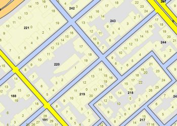
In the year 2000, Terra completed the production of the Building Blocks geographical database for Greece which since then it constantly maintains and updates. The building blocks database is of high accuracy (scale of 1: 5,000) and covers 607 town and villages all over the country. Each building block geo-data feature is accompanied with ELSTAT 2001 Census population and demographic attributes:
- ELSTAT 2001 building code (Κωδικός οικοδομικού τετραγώνου ΕΛΣΤΑΤ 2001)
- municipality name (Ονομασία Δήμου)
- ELSTAT 2001 municipality code (Κωδικός ΕΛΣΤΑΤ 2001 Δήμου)
- ELSTAT 2001 full building block code (Πλήρης κωδικός ΕΛΣΤΑΤ 2001)
- Real population (Πραγματικός πληθυσμός)
- Resident population (Μόνιμος πληθυσμός)
- number of Resident households (Πλήθος μόνιμων νοικοκυριών)
- number of houses (Πλήθος κατοικιών)
- number of owned houses (Πλήθος ιδιόκτητων κατοικιών)
- number of conventional dwellings for rent (Πλήθος ενοικιαζόμενων κατοικιών)
- Number of occupied conventional dwellings (Κατοικίες κατοικούμενες)
- Number of vacant conventional dwellings (Πλήθος κενών κατοικιών)
- number of conventional dwellings for main use (Κατοικίες κύριες κατοικούμενες)
- number of conventional dwellings for seasonal or for secondary use (Κατοικίες εξοχικές ή δευτερεύουσες)
- number of females (Αριθμός Γυναικών)
- number of males (Αριθμός Ανδρών)
- permanent population of 0-14 age group (Μόνιμος πληθυσμός ηλικίας 0 – 14)
- permanent of 15-64 age group (Μόνιμος πληθυσμός ηλικίας 15 – 64)
- permanent population of 65 and over age group (Μόνιμος πληθυσμός ηλικίας 65 και άνω)
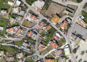
Terra maintains the 2D buildings footprints (building contours) geographical database of scale 1: 5,000 that cover 543 towns & villages across the country totaling to approximately 2,050,000 buildings. The last update of the database has been made in 2006.
Terra also maintains and updates on a continuous basis the Postal Codes (ZIP) boundaries which are complementary to the road network and address database. Postal Codes boundaries carry as attribute information the ELSTAT 2001 Census data.
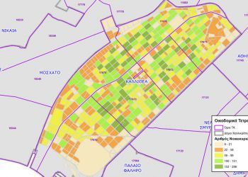
Last, other Administrative Boundaries geographic datasets include the Coastline of Greece and the Regions, Prefectures & Kapodistrias & Kallikratis municipalities’ boundaries.


