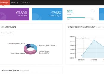
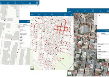
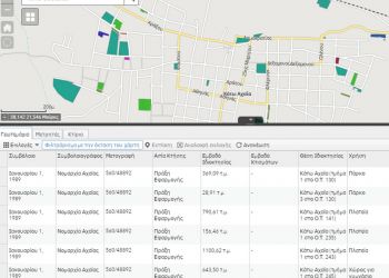
DEPAN: Urban Data Logging and Management Services using the integrated SmartOTA digital platform
Smart cities for DEPAN members
The SmartOTA digital platform is an integrated system for the recording and management of Geographical Data, based on modern technologies, for DEPAN members, in order to meet the following needs:
- E-Government Platform in Web, Desktop, and Mobile
- Geographical Information Registration & Retrieval System
- Decision Making System for GeoSpatial Content
- Event management, incident and crisis management, prevention, citizen protection, statistical research, analysis, etc.
- Energy consumption reduction, Environmental Protection and Cost Savings
Infrastructures that are the subject of Applications
| Real Estate | Irrigation | Public Works |
| Buildings | Wells | Technical Projects |
| Land Parcels | Network | Information systems in the management of technical projects |
| Counters | Pumps | Legislation and Safety of Technical Works |
| Urban Lighting | Desalination | Municipal Fees |
| Wells | Panels | Cleaning & Lighting |
| Network | Counters | Electrified Areas |
| Panels | Road Network | Property Tax |
| Towers | Streets | Entertainment Venues, Restaurants and related Services |
| Lighting | Road Signs | Use of Public Areas |
| Counters | Street Signaling | Urban & Spatial Planning |
| Water supply / Sewerage | Parking spaces | Land use |
| Wells | Public transport | Building/Property Lines |
| Network | Outdoor advertising | Public Areas |
| Pumps | Green Areas / Municipal Cleansing Service | Construction rules |
| Organic | Buckets | Special Protection Areas |
| Desalination | Green points | Settlement Boundaries |
| Panels | Management Units | Zones |
| Counters | Green areas |
SmartOTA Platform
The platform is based on current state-of-the-art technologies for the web and is accessible to all modern browsers, smartphones and tablets. It consists of the base application (web & mobile) and mobile collector data system designed and implemented in ESRI technology.
Subsystems / Applications
The following table shows the discretely interconnected subsystems (services) of the SmartOTA platform. For each subsystem, the entities that deal with, the subject and the purpose of the subsystem are displayed.
| Service | Entities | Objective | Purpose |
| Real Estate | Buildings | Registration of municipality’s Real estate | Optimal Property Management |
| Land Parcels | Locating properties on the map | Direct detection of available spaces | |
| Counters Organic | View the documents that accompany the property | ||
| Leasing Management | |||
| Reports of electricity consumption | |||
| Urban Lighting | Wells | Recording an existing status: | lighting quality improvement |
| Network | Number of bulbs per tower | light pollution and glare minimization | |
| Panels | Kind of tower | Aesthetic upgrade | |
| Towers | Tower construction material | Safety | |
| Lighting | Height of bulb placement | Saving energy and resources | |
| Counters | Lamp intensity | Reduction of CO2 emissions | |
| Bulb status | |||
| Water supply / Sewerage | Wells | Recording existing status | Assessment of the existing equipment status |
| Network | Equipment quality optimization | ||
| Pumps | Equipment operation optimization | ||
| Organic | Saving energy and resources | ||
| Desalination | Reduction of CO2 emissions | ||
| Panels | |||
| Counters | |||
| Irrigation | Wells | Recording existing status | Assessment of the existing equipment status |
| Network | Equipment quality optimization | ||
| Pumps | Equipment operation optimization | ||
| Desalination | Saving energy and resources | ||
| Panels | Reduction of CO2 emissions | ||
| Counters | |||
| Road Network | Streets | Recording existing status | municipality portal (city guide) |
| Road Signs | Effective traffic flow management | ||
| Street Signaling | Detecting damaged road signs | ||
| Parking spaces | Detecting illegal billboards | ||
| Public transport | Tax on the advertised business | ||
| Outdoor advertising | |||
| Green Areas / Municipal Cleansing Service | Buckets | ||
| Green points | |||
| Management Units | |||
| Landfill Site | |||
| Sanitary Landfill Sites | |||
| Recycling Units | |||
| Green areas | |||
| Public Works | Technical Projects | ||
| Information systems in the management of technical projects | |||
| Legislation and Safety of Technical Works | |||
| Municipal Fees | Cleaning & Lighting | ||
| Electrified Areas | |||
| Property Tax | |||
| Entertainment Venues, Restaurants and related Services | |||
| Use of Public Areas | |||
| Urban & Spatial Planning | Land use | Create a map of building terms | Upgrading the services of the Building Service |
| Building/Property Lines | Building control tools provision | ||
| Public Areas | |||
| Constraction rules | |||
| Special Protection Areas | |||
| Settlement Boundaries | |||
| Zones |
The design and development of the Web Digital Platform “SmartOTA” was done by DEPAN in cooperation with our company.


