

ePoleodomia
The project “ELECTRONIC URBAN PLANNING: GEOGRAPHICAL INFORMATION SYSTEMS FOR THE PREFECTURES OF THE COUNTRY”, amounting to EUR 11,2 million, launched by the Information Society that was assigned to the association “SingularLogic Integrator SA”. – Intrasoft International SA” is one of the most important and largest IT projects for the modernization of Public Administration.
The purpose of the project is to provide the employees of urban and city planning organizations, citizens and civil engineers with fast and valid information on urban geographical data as well as the total of the relevant town planning legislation of each prefecture in order to better serve them better. At the same time, it aims at the more efficient operation of the organization departments, providing immediate information about the specific terms – conditions, the building restrictions and the current legislation of urban and city planning. The implementation of the project will improve the efficiency of the internal processes of the prefectural planning services and their operation, significantly upgrading the quality of the services provided to the citizens.
Specifically, the project includes the production of digital urban planning cartographic maps & datasets and provides act of implementations (applications) and control services in the respective maps of all Official Government Gazette and planning data (using the Geographical GIS Information System), the design and development of spatial database of local terms and conditions in building restrictions, the supply and installation of necessary equipment and software, the development of a Geographic information System to manage city planning building regulations details, the disposal of important planning information and maintenance and technical support services.
The subject of the INTRASOFT – TERRA Contract
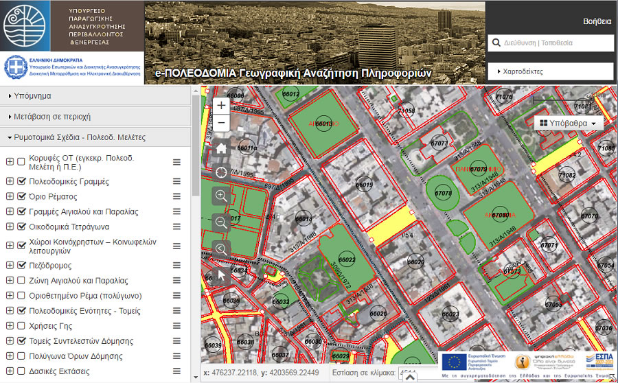
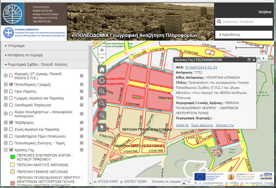
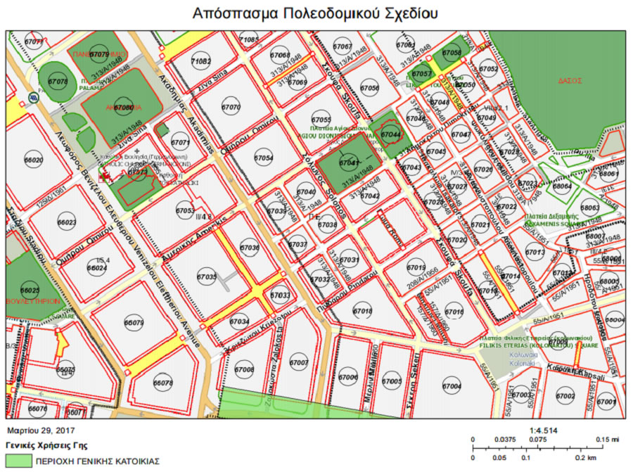
In February 2015, INTRASOFT has contracted to Terra for part of the project to create an integrated Geographic Information System with registration and updating of geospatial and descriptive urban planning information and a suitable “Search Engine, Overview & Presentation Tool” in WebGIS environment.
More specifically, Terra undertook the following tasks:
- Information Search and Retrieval
- Dynamic map presentation and basic navigation tools
- Spatial search tools and presentation of the results
- Map information display
- Local regulation information (terms and conditions of restrictions in land and buildings usage)
- Thematic maps production
- Help utilities
- Security-Users
- Spatial Database
- Design and development of a geospatial database
- Geospatial database update
- Security-Users
- Interoperability – INSPIRE
- Users Groups roles and rights
- Technical support